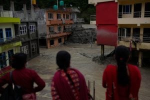
When they received the first deforestation alert and the exact coordinates on their mobile phones, the custodians of the indigenous community of Infierno, of the Ese’eja ethnic group, headed into the forest of Madre de Dios, in the Peruvian Amazon. Arriving at a clearing in the forest, the veracity of the alert was confirmed as they witnessed five people slashing trees.
An acoustic monitoring system had only recently been installed inside the 1,500 hectares of land that the community manages and promotes ecotourism within. “Thanks to the sound sensors, we heard the chainsaw,” says Ruhiler Aguirre Mishaja, the project’s coordinator in the Infierno community.
In the last decade, different Amazonian native communities, such as Infierno, have kept illegal loggers at bay and defended territories with technologies ranging from artificial intelligence, satellite imagery, geo-referenced mobile phone applications or unmanned aerial vehicles (drones).
Did you know?
51.6% of the Peruvian Amazon is under some form of state protection or on native community lands.
Their battle is a vital. Around 17% of global greenhouse gas emissions come from deforestation. Recent research published in the journal Frontiers in Forests and Global Change warns that damage to areas of the Amazon – the world’s largest tropical forest – could be worsening the effects of climate change.
Protecting the forest
Evidence shows that areas under the supervision of native peoples or the state, which account for 51.6% of the Peruvian Amazon, are deforested less than those considered “no man’s land”. The Environmental Defense Fund found that between 2000 and 2015, Peru’s indigenous territories lost 1.96% of its forest cover, while protected natural areas lost 0.59%. In contrast, unmonitored lands suffered the loss of 4.41% of vegetation.
Jason Kopas, a researcher and lawyer with Earthjustice, an international environmental organisation, told Diálogo Chino that legal recognition and titling of indigenous territories is an important first step in improving forest management. With clear boundaries, communities can take better advantage of monitoring technologies. In Loreto, the Peruvian region with the largest forested area, only 744 out of 1,221 recognised communities have managed to title their land.
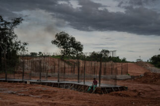
But while native peoples seek sustainability, capital covets the riches of the forest. The Amazonian Network of Geo-referenced Socio-environmental Information (RAISG) warns that 65.8% of the Amazon is under pressure from extractive and agricultural activities, along with roads and hydropower developments. The data does not include illicit activities such as illegal mining and logging or the cultivation of coca for drug trafficking.
The Peruvian Ministry of Environment publishes information from the national satellite PerúSat-1, launched in 2016, through its GeoBosques platform. This allows it to identify deforestation alerts in real time. However, many native communities do not have access to the internet. Bridging this gap in the availability of timely information is key to curbing deforestation.
The latest field study by the US’ Proceedings of the National Academy of Sciences into indigenous people’s role as forest stewards analysed 76 communities in Loreto and divided them into two groups: a control group and an experimental group. In the latter, consisting of 36 communities, it appointed monitors who were given smartphones with a geolocation application.
The hope is that by empowering communities on the frontline, they can use this information to better interact with the state and better request assistance when needed
Once a month, due to the lack of internet access, each community downloaded the information with the alerts obtained from Geobosques onto their new smartphones, enabling them to plan patrols. According to the findings, deforestation in their territories fell by 52% in 2018 and 21% in 2019. The project continues and is expected to scale up.
“The hope is that by empowering communities on the frontline, they can use this information to better interact with the state and better request assistance when needed,” says Kopas, also a co-author of the study conducted with support from the Rainforest Foundation US and the Regional Organisation of Indigenous Peoples of the East (ORPIO).
The Tikuna apu (indigenous leader) Francisco Hernández, who is president of the Federation of Tikuna and Yahuas Communities of the Lower Amazon (FECOTYBA), near the triple border with Brazil and Colombia, says that eight communities from his federation participated in the experience.
“We have found many things that had never been seen before and we have solved others,” he says. “There were communities that didn’t know what their boundaries were or what was inside their territories,” he says. They discovered the presence of foreigners, illegal sawmills and illegal plantations.
In recent years, according to Hernández, the area has been suffering from “voracious deforestation” linked to illegal coca cultivation. “In the communities where it has not been monitored, deforestation continues to advance little by little,” he warns.
Ears to the trees
Madre de Dios is located in the southern Peruvian Amazon, which borders Bolivia. There, the native community of Infierno has been part of an international project led by Rainforest Connection since 2018. This non-profit start-up creates sound sensors with microphones from used phones, powers them with solar energy and places them high in the trees. Rainforests are noisy, but the artificial intelligence that analyses the audio can differentiate between nature and chainsaws.
César Ipenza, an environmental justice researcher, says that authorities at the location in question must corroborate the information generated by satellite monitoring in order to punish environmental crimes. “Travelling to the deforestation zones for an inspection, to see and contrast what is seen in the image, is a challenge. Land trips of days or hours make this response [by the state] complicated,” he points out.
This same situation occurred in the Infierno community in February 2018, at the beginning of the eco-acoustic monitoring project, when its members were alerted and found those five loggers. The Environmental Prosecutor’s Office arrived that time but could not arrest them because the police were not present at the scene. They were also unable to identify the criminals, who gave false information.
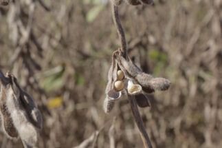
Aguirre recalls that they felled 11 shihuahuaco trees and a species of moena. “That has a very high value,” he laments.
A month later, a new alert appeared. After a five-hour journey, the administrative and fiscal authorities arrived again, this time with the police. Two loggers were arrested in flagrante delicto. Today, however, they are free, Aguirre claims, despite all the evidence gathered as a result of the alert.
190
thousand hectares lost in Peru in 2020
With the Covid-19 pandemic and travel difficulties, Infierno’s “ears” have begun to close. However, the Ese’eja hope to continue to monitor their entire forest with other satellite imaging platforms.
Data from Global Forest Watch shows that in 2020 Peru recorded its highest figure for primary forest deforestation at 190,000 hectares. This is equivalent to an area larger than the city of London.
Technology alone is not enough
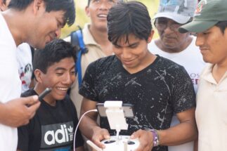
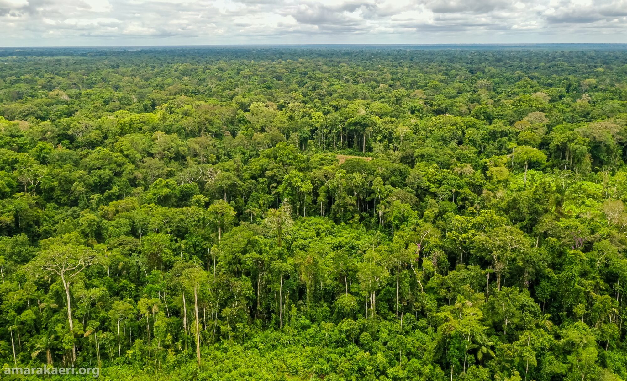
For five years now, Luis Tayori, a Harakbut leader, has been flying drones over the 402,000 hectares of the Amarakaeri Communal Reserve in Madre de Dios, reducing the safety risks of patrolling on foot. He has a bird’s eye view of the vast protected natural area, which is also the Harakbut’s ancestral territory.
Tayori is also one of eight pilots certified by the Ministry of Transport in the surveillance team he leads. In partnership with Conservación Amazónica, the Pontificia Universidad Católica del Perú and the start-up Qaira, they receive training and advice on the acquisition and maintenance of the drones, which must be adapted to the conditions of the environment, the size of the territory and the demands of patrolling.
Since its creation in 2002, the reserve has conserved 98.5% of its forest. It is co-managed by the ECA Amarakaeri – an organisation made up of 10 communities of the Harakbut, Yine and Machiguenga ethnic groups – and the Peruvian National Service of National Protected Areas (Sernanp). But it is not free of danger.
Madre de Dios is the Peruvian region most devastated by the gold rush. An analysis by the Centre for Amazonian Scientific Innovation found that between 2009 and 2017 gold mining was responsible for the loss of more than 95,000 hectares of forest. Walter Quertehuari, president of ECA Amarakaeri, says there is no illegal mining in the reserve, but there is a lot of pressure from this activity in the periphery.
Camanti, located a few metres from the protected area, is one such case. The Monitoring of the Andean Amazon Project (MAAP) identified 105 hectares in the locality that were deforested at the hands of illegal miners between March 2019 and October 2020 alone. The activity also generates water contamination, human rights violations, organised crime and conflicts with local populations.
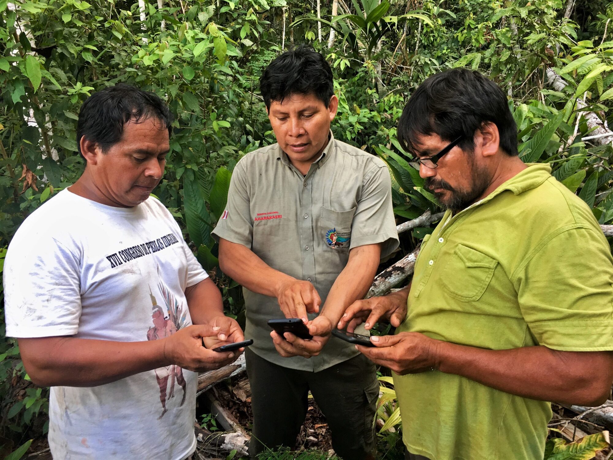
Surveillance in Amarakaeri is constant. There are 24 community guards in addition to the 14 Sernanp park rangers and technical staff. Since 2018, they have all been monitoring through the Mapeo Mobile application, which allows them to collect data from the forest without internet access and to produce digital reports. They then use Mapeo Desktop, a computer version for managing and analysing all the data.
The software was designed by the communities themselves along with Digital Democracy, an organisation that supports marginalised communities with technological know-how. According to the organisation, up until June 2021 the platform has collected 150 pieces of evidence of human activities inside the reserve and the buffer zone. Thirty legal actions were initiated.
“It’s about replacing human activities, but in this time we have realised that technology is not enough and we have to go to the field to verify, whether it’s because of bad weather or other reasons,” Tayori explains. “It worries us.”
The Harakbut leader believes that the state should concentrate its efforts on ensuring the security of environmental defenders who receive threats. Whitsleblowing is discouraged by the sense that authorities are not paying attention.
“The institutions themselves have not looked into this issue in depth. It happens to us, who are in rural areas, and it is not a habit to report,” Tayori says.